School and GIS resources
We've produced a range of resources, from teaching materials to an interactive map of Victorian crops.
School resources
Year 9 Geography: Biomes and Food Security
Foodprint Melbourne teaching resources and lesson plans to support delivery of the Year 9 geography unit 'Biomes and food security'.
VCE Food Studies
Resources from the Foodprint Melbourne project can be used when teaching the VCE Food Studies subject.
General resources
The Foodprint Melbourne project team has collated a range of external resources for teacher use across a variety of food systems subjects.
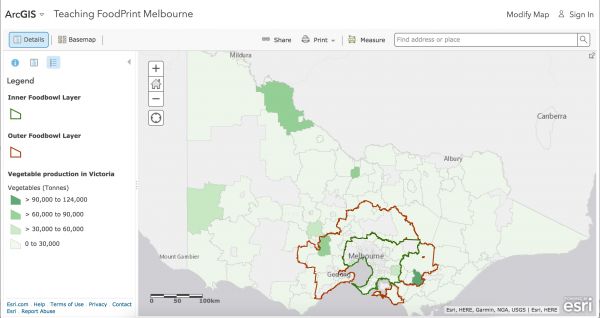
GIS mapping resources
The Foodprint Melbourne project has developed an online GIS map that draws together data to help stakeholders understand what grows where in Melbourne's foodbowl and its distinctive characteristics.
Sign up for the Foodprint Melbourne newsletter for project updates