
Learn to identify vulnerabilities and map assets for resilience
Assess and map local and regional food systems to identify vulnerabilities and assets
Key steps and tools
-
Food systems are being affected by more frequent and severe shocks that disrupt food supply chains, such as climate shocks, pandemic and geopolitical events. They are also under pressure from long-term stresses, such as drought and sea-level rise.
The impacts of these shocks and stresses are felt throughout food supply chains from food production to consumption and the generation of waste. The greatest impacts will be felt by communities who are most vulnerable and already at risk of food insecurity [1].
There are five key steps to assessing food system resilience:
- Understand potential shocks and stresses that may affect the local or regional food system
- Consider the people and places that are likely to be most affected
- Identify activities, organisations and infrastructure across food supply chains
- Map community food systems
- Identify food system assets and vulnerabilities
Use this assessment to identify actions that build long-term resilience of the food system to any future shock or stress.
Tools and templates
- A template to identify food system vulnerabilities and assets
- Foodprint Melbourne Resilient food supply chain infographic
- Foodprint Melbourne GIS resilience map which shows areas of Victoria that are vulnerable to climate hazards
-
Victoria is predicted to become drier and hotter due to climate change. It is likely to experience more extreme temperature days, heatwaves, bushfires and drought, but also extreme rainfall events, floods, and sea-level rise [2]. Consider how these shocks and stresses may disrupt local or regional food systems in Victoria.
Spatial mapping of food system infrastructure and assets in relation to climate hazards is important, but it requires technical capabilities and data that may not be readily available. However, general GIS mapping resources and climate dashboards for Victoria are also a useful source of data (see below).
Note: common approaches to understanding climate shocks and stresses use terminology and processes related to hazard and risk assessment that can be technical. We have tried to simplify language and processes here to make them accessible to all users.
Tools and templates
- The Foodprint Melbourne GIS resilience map shows areas of Victoria that are vulnerable to climate hazards
Recommended external resources
Victoria’s Future Climate Tool from the Victorian Government provides climate projections and scenarios to inform decision making.
VicPlan mapping tool from the Victorian Government shows bushfire prone areas for rail, road and freight networks
-
Collect data in the region about people and places to identify which communities and assets in the built and natural environment are likely to be most affected in the event of a shock or stress. Collect data that relates to key food systems domains (equity, health, environment and economy), including data relating to the demographics, health and livelihoods of the population.
Potential data sources about people and places
Food system domain Questions to consider Potential data sources Equity What are the population demographics of the area? Census - Australian Bureau of Statistics Which populations are likely to be most vulnerable to food system shocks? ABS Data by region Health What is the health status of the population? VAHI Victorian population health survey Environment Where are the natural and built environment assets of the local area? Economy What is the labour market and employment profile of the area? Employment Region Dashboards and Profiles | Jobs and Skills Australia What are people’s livelihoods? Regional Economic Development Strategies (REDS) - Regional Development Victoria -
A food system includes all the actors and activities involved in producing, processing, distributing, retailing, consuming and disposing of food, and the interactions between them.
Gather data about activities, organisations and infrastructure across stages of the food supply chain. Identify food system activities from farm to fork – what the activities are, who undertakes them, at what scale and where. This can help to identify assets that strengthen food system resilience and points of vulnerability to shocks and stresses.
A profile can be developed for a local food system (e.g. a local government area) or a regional food system (e.g. several local government areas or a state). Expanding the scope of a food system profile beyond local government boundaries may enable more stages of the food supply chain to be mapped, e.g. expanding a profile for an urban local government area into surrounding areas of food production.
Data and data sources to create a food system profile
Food supply chain stage Questions to consider Potential data sources Production - What foods are grown in the region? How much is grown and where? Consider Aboriginal food enterprises and sources of culturally diverse foods
- What land could be used to produce food?
- What water sources are available?
Foodprint Melbourne GIS map of Melbourne’s foodbowl Processing - What food processors are in the region? Where are they?
- What scale are the enterprises (small, medium, large)?
- What do they produce?
Contact your local government Distribution - Where are the food distribution hubs? (e.g. supermarket distribution centres, wholesale markets)
- What are the major food transportation routes in the region?
Foodprint Melbourne GIS resilience map of Victoria’s food system Retail - Where are the food outlets in the area? e.g. supermarkets, public markets, independent grocers
- Is there diversity in food retail outlets in the region?
Australian Urban Observatory GIS map – food access Consumption - What is the prevalence of food insecurity in the local area?
- What proportion of people are living in poverty in the area?
Victorian Public Health and Wellbeing Outcomes Dashboard VCOSS Mapping poverty in Victoria
Waste resources - How much household food and organic waste is collected in the area?
Victorian local government waste data dashboard Recommended external resources
Food system resilience: A planning guide for local governments from the John Hopkins Center for a Liveable Future and the Bloomberg Center for Government Excellence, Module 4: Assess, p59-91
Building Sustainable and Resilient City Region Food Systems Assessment and Planning Handbook from the Food and Agriculture Organization (FAO) of the United Nations, Chapter 2.3: Rapid scan, p52-83
-
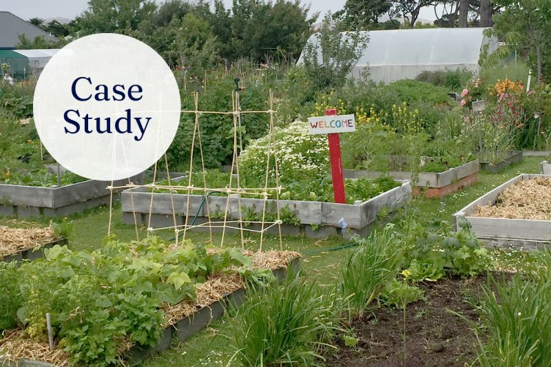
Community food activities can strengthen resilience by diversifying and decentralising food systems and by building community [1]. Community food activities can include farmers’ markets, food swaps, community gardens, urban farms, and food justice initiatives such as community meals, food banks and food pantries.
Participatory mapping workshops that involve food system and community actors can be an effective way to map community food assets. Invite a diverse range of community partners that can help to map these assets. Consider developing a map of community food assets and infrastructure.
Community food activities and data sources
Food supply chain stage Community food activity Possible data sources Production Where are the local food producers, food swaps and food justice organisations? Australian Regenerative Food & Farming Map Where are the community gardens and urban farms in the local area? Community Gardens Australia Distribution and retail Where are the local food hubs? Where are the local food swaps and food justice initiatives?
Australian food hubs Consumption Where are the local food relief organisations? Community Information & Support Members Waste resources Where are the local community composting hubs? Recommended external resources
Food Partnership and Strategy Toolkit from Sustainable Food Places (UK), which includes a food system mapping tool to run a mapping workshop
-
Use data gathered (see steps above) to identify food system assets in the local or regional food system that build resilience. Also consider assets identified through community food mapping.
Potential assets
Potential asset Issues to consider Diversity - Food production – diverse crops and regenerative modes of production, sourcing food from diverse regions (local and regional, as well as state, national and global), community and commercial production
- Food supply chains – diverse types of supply chains, short as well as long (including regional and direct to consumer), large and small scale enterprises, diverse retail options (including independent stores and public markets)
- Transport networks – multiple routes and modes of food transportation into the region
Decentralisation - Multiple food nodes – e.g. many smaller distribution centres, processing facilities and retail options rather than a small number of large ones
Networks and collaboration - Food system and community networks e.g. food system alliances and coalitions, cross-sector networks, neighbourhood mutual aid networks
Circular food economies - Recycling of food waste and organic waste to keep valuable nutrients in the food system
- Recycling of wastewater for food production
Sustainable livelihoods - Fair, safe and secure work in food and farming in the region
Participatory governance - Opportunities for citizens and a broad range of food system stakeholders to engage in shaping the food system
- Opportunities for people with lived experience of food insecurity to participate in shaping dignified solutions in the region
Draws on Murphy et al. 2022 -
Use data gathered (see steps above) to identify vulnerabilities in the local or regional food system and understand the potential impacts of shocks and stresses across food supply chain activities, organisations and infrastructure.
Potential vulnerabilities
Potential vulnerability Issues to consider Geographic location - In which locations are activities, organisations and infrastructure likely to be most at risk to specific shocks and stresses (e.g. fire, riverine flood, sea level rise)?
- Are key food system activities concentrated in particular geographic locations that may be at risk? e.g. supermarket distribution centres, wholesale markets or warehouses?
- Are food transportation networks distributing food in and around the region potentially at risk?
Corporate concentration - Do a small number of corporations dominate in sectors or stages of the food supply chain?
Complex supply chains - Do long and complex, ‘just-in-time’ food supply chains dominate in the region?
Centralisation - Are there a just a few large centres for critical facilities such as food processing centres, warehouses or distribution centres?
Interdependent systems - Are interdependent systems vulnerable in the region? Consider energy, telecommunications, water, banking and finance
Insecure employment in food and farming - Are workers in food and farming in casualised and insecure employment? Do they have poor working conditions?
Draws on Murphy et al. 2022 -
[1] Murphy, M., Carey, R., and Alexandra, L. (2022) The resilience of Melbourne’s food system to climate and pandemic shocks. University of Melbourne, Australia. https://doi.org/10.46580/124370
[2] Department of Energy, Environment and Climate Action (2024) Victoria’s Climate Science Report 2024, Victorian Government.
Assessing the resilience of food systems in Aotearoa New Zealand
- Climate shocks and stresses are impacting food systems and contributing to rising food insecurity in Aotearoa New Zealand
- The Queenstown Lakes District and Greater Christchurch have assessed and mapped their food systems
Key concepts
Sign up for the Foodprint Melbourne newsletter for project updates